Understanding Cirrostratus Clouds and Their Atmospheric Significance
What Are Cirrostratus Clouds?
Cirrostratus clouds are a fascinating atmospheric phenomenon, recognized for their high altitude and thin, sheet-like appearance. Typically covering the entire sky, these clouds are so translucent that celestial bodies like the Sun and Moon can often be seen through them. This characteristic visibility, coupled with the distinctive halo effect they produce, makes cirrostratus clouds a subject of interest for both meteorologists and amateur sky-watchers.
The formation of cirrostratus clouds occurs high in the troposphere, generally between 6 to 13 kilometers (20,000 to 43,000 feet). They are composed entirely of ice crystals, which play a crucial role in their optical properties. The term 'cirrostratus' itself derives from Latin, combining 'cirro-' meaning curl or wisp, and 'strato-' meaning layer, aptly describing their wispy, layered nature.
Distinguishing Characteristics of Cirrostratus
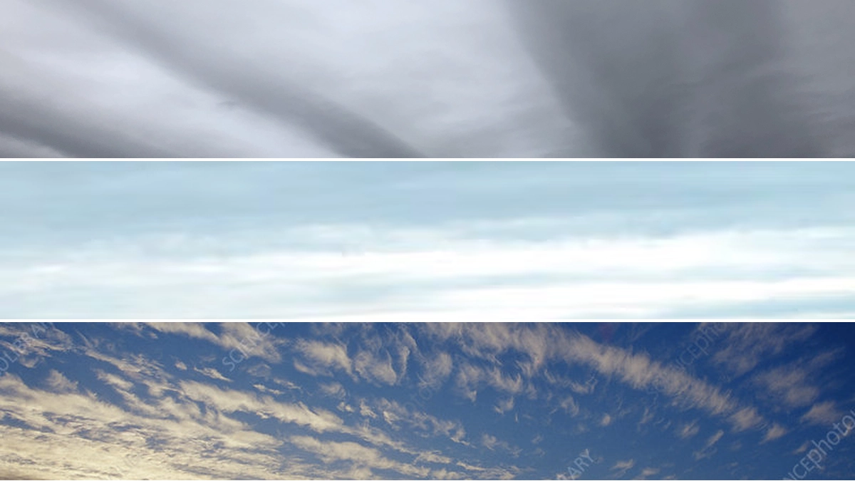
Cirrostratus clouds present a pale, veil-like layer across the sky. Unlike denser cloud types, they rarely obscure the sun or moon. Their transparency is a key identifier, often making them appear hazy or almost indistinguishable from the sky itself.
Cloud Species and Varieties
Two primary cloud species are associated with cirrostratus:
- Cirrostratus fibratus: This species is characterized by its fibrous, hair-like appearance. It often looks like delicate threads spread across the sky.
- Cirrostratus nebulosus: This variety presents a more uniform, hazy, and featureless veil, lacking discernible details.
In addition to species, cirrostratus clouds can exhibit certain varieties:
- Cirrostratus undulatus: This variety displays a wave-like pattern, creating undulating streaks within the cloud layer.
- Cirrostratus duplicatus: This involves multiple, superimposed layers of cirrostratus, giving the appearance of a thickened, multilayered veil.
The Phenomenon of the Cirrostratus Halo
One of the most striking features attributed to cirrostratus clouds is the 22° halo. This optical phenomenon occurs when sunlight or moonlight passes through the hexagonal ice crystals that make up the cloud. As light refracts and reflects off these crystals, it creates a luminous ring, often colorful, around the Sun or Moon. The size of this halo is roughly equivalent to the width of a hand held at arm's length.
The presence of a cirrostratus halo is a direct indicator of the cloud's composition and altitude. It signifies that the ice crystals are optimally positioned to refract light in this specific manner. While other high-level clouds like cirrus and cirrocumulus can also produce halos, cirrostratus clouds are most commonly associated with this phenomenon due to their uniform, extensive nature.
Cirrostratus Clouds and Weather Prediction
Meteorologically, cirrostratus clouds serve as important indicators of impending weather changes. Their appearance often precedes a warm front, signaling that precipitation may be on the way. Typically, these clouds indicate that rain or snow is likely to occur within the next 12 to 24 hours.
Observing the progression of cirrostratus clouds can offer valuable insights into short-term weather forecasts. For instance, if cirrostratus clouds thicken and lower into altostratus clouds, it generally suggests that precipitation is becoming more imminent.
Distinguishing Cirrostratus from Similar Cloud Types
Differentiating cirrostratus from other high-altitude clouds like cirrus and cirrocumulus is crucial for accurate identification.
- Cirrostratus vs. Cirrus: While both are high-level and can appear fibrous, cirrus clouds are typically more detached, wispy, and often exhibit comma or fishbone-like shapes. Cirrostratus, in contrast, forms a more continuous, veil-like layer.
- Cirrostratus vs. Cirrocumulus: Cirrocumulus clouds appear as small, white patches or ripples, often described as looking like grains of sand or fish scales. Cirrostratus lacks this distinct textured appearance.
- Cirrostratus vs. Altostratus: Altostratus clouds are mid-level clouds that form a thicker, more uniform gray or bluish sheet. While they can also produce a halo effect, they are generally more opaque than cirrostratus, often obscuring the sun or moon, or making them appear as if seen through ground glass. The primary distinction lies in altitude and opacity.
The Meaning and Etymology of Cirrostratus
The cirrostratus meaning is deeply rooted in its descriptive nature. As mentioned, 'cirro-' implies curl or wisp, and 'strato-' denotes a layer. This combination perfectly captures the essence of these clouds: thin, high-altitude layers that often have a fibrous or veiled appearance. Understanding this etymology aids in visualizing and identifying the cloud type.
Observed Examples and Types
Throughout meteorological observation, various forms of cirrostratus have been documented:
- Cirrostratus fibratus undulatus: A combination of fibrous texture and wave-like patterns.
- Cirrostratus (Cs): The general classification for these high-level, sheet-like clouds.
What Does Cirrostratus Sound Like?
Regarding cirrostratus pronunciation, it is typically rendered as /ˌsɪr.əʊˈstrɑː.təs/ in British English and /ˌsɪr.oʊˈstreɪ.t̬əs/ in American English. While clouds themselves do not produce sound, their presence is linked to atmospheric conditions that can influence sound propagation.
Supplementary Features and Associated Clouds
Cirrostratus clouds do not typically possess supplementary features. However, they can be related to other cloud formations. For instance, cirrostratus homomutatus indicates a mutation from a homogenitus cloud, which is man-made, like those from aircraft contrails. These clouds are essentially man-made cirrus formations that have spread out into a cirrostratus sheet.
Conclusion: Identifying Cirrostratus in the Sky
Cirrostratus clouds are identifiable by their high altitude, thin and transparent veil-like appearance, and the common presence of a 22° halo around the Sun or Moon. While they don't produce precipitation themselves, their appearance is a key precursor to impending weather systems, typically signaling rain or snow within 12 to 24 hours. Recognizing cirrostratus undulatus and other species helps in understanding atmospheric conditions. By observing these celestial veils, one can gain a better appreciation for the dynamic nature of our atmosphere and its subtle weather predictions.
Key Takeaways for Identifying Cirrostratus Clouds:
- Appearance: High, thin, transparent, sheet-like layer covering much of the sky.
- Halo Effect: Often produces a 22° halo around the Sun or Moon due to ice crystals.
- Predictive Value: Usually indicates approaching precipitation within 12-24 hours.
- Distinction: Differentiated from cirrus (wispy, detached elements) and cirrocumulus (rippled, granular appearance).
- Composition: Primarily composed of ice crystals.
 21/07/2026