Understanding Tropical Depressions: From Formation to Forecasting
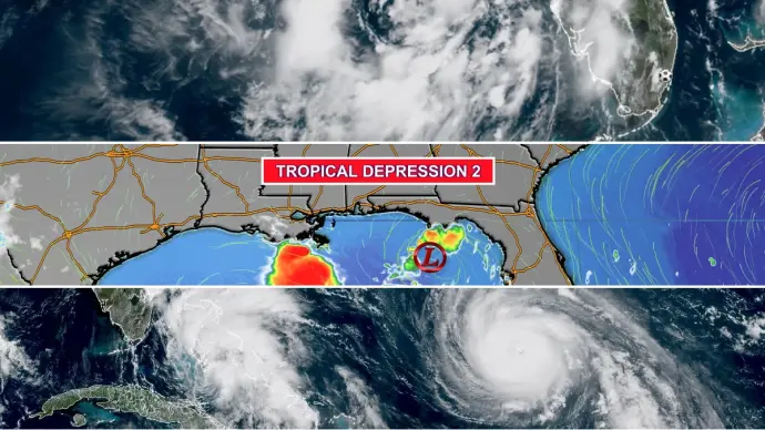
A tropical depression represents the initial stage in the development of a tropical cyclone. It is characterized by a low-pressure area at its center, around which a group of thunderstorms organize and exhibit some degree of rotation. While appearing somewhat disorganized from satellite imagery, the presence of organized convection is a key indicator. These systems are systematically numbered by meteorological agencies, such as the National Hurricane Center, to track their progression throughout a season.
The Life Cycle of a Tropical System
The transformation of a weather system from a tropical depression to a hurricane involves distinct phases, each defined by specific wind speeds and organizational characteristics.
From Depression to Storm
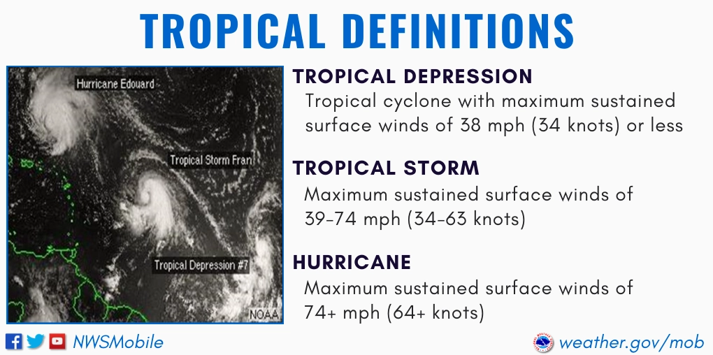
A tropical depression is officially designated as such when its sustained wind speeds reach up to 39 miles per hour. At this stage, the system begins to exhibit more pronounced weather impacts, often including heavy rainfall and increased wind activity. These depressions are assigned numbers sequentially as they form during a given hurricane season. For instance, TD8 signifies the eighth tropical depression of that season.
Tropical Storm Formation
When the sustained wind speeds within a tropical depression increase and consistently exceed 39 mph, the system is then classified as a tropical storm. This escalation signifies a more organized and potentially hazardous weather phenomenon. Tropical storms are assigned names from a predetermined list, which aids in communication and public awareness. The naming convention is a critical aspect of tropical cyclone tracking and warning systems.
The Birth of a Hurricane
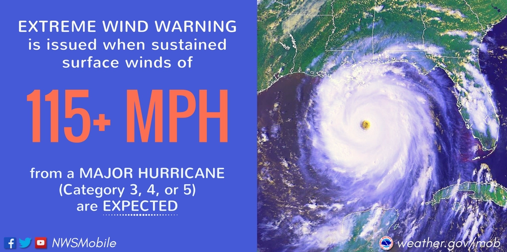
The most intense phase, a hurricane, is reached when a tropical storm's sustained wind speeds surpass 74 mph. This threshold indicates a powerful and destructive weather system, easily recognizable by its distinctive spiral shape and a clear central eye. Hurricanes are further categorized using the Saffir-Simpson Hurricane Wind Scale, from Category 1 to Category 5, based on their wind intensity. These powerful storms can persist for weeks, drawing energy from warm ocean waters.
Key Definitions in Tropical Meteorology
Understanding the terminology used by meteorologists is essential for comprehending tropical weather events.
- Tropical Wave: An inverted trough or an elongated area of relatively low pressure moving generally east to west across the tropics. These waves can serve as a genesis point for tropical cyclones. They are also referred to as easterly waves.
- Tropical Disturbance: A localized tropical weather system, typically 100 to 300 miles in diameter, characterized by organized convection. It migrates and maintains its identity for at least 24 hours, though it may not always have a detectable wind field perturbation.
- Tropical Cyclone: A warm-core, non-frontal synoptic-scale cyclone forming over tropical or subtropical waters. It features organized deep convection and a closed surface wind circulation around a well-defined center. Its energy is derived from the ocean's heat.
- Potential Tropical Cyclone (PTC): A designation used in advisories for a system that is not yet a tropical cyclone but poses a significant threat of bringing tropical storm or hurricane conditions to land within 48 hours.
- Invest: A weather system that a tropical cyclone forecast center has identified as being of interest for specialized data collection or model guidance, indicating potential development.
The Role of Tropical Depressions in Forecasting
Tropical depressions, while the weakest form of tropical cyclone, are critical indicators for forecasters. Their initial formation alerts meteorologists to areas of atmospheric instability and the potential for more significant weather development. Monitoring the track and intensity changes of a tropical depression allows for timely warnings and preparations for potential tropical storm or hurricane impacts.
When a tropical depression sustains wind speeds over 39 MPH, it is upgraded to a tropical storm. This transition highlights the system's increasing organization and potential for causing damage. The naming of tropical storms by agencies like the National Hurricane Center is a vital part of disseminating information and ensuring public safety.

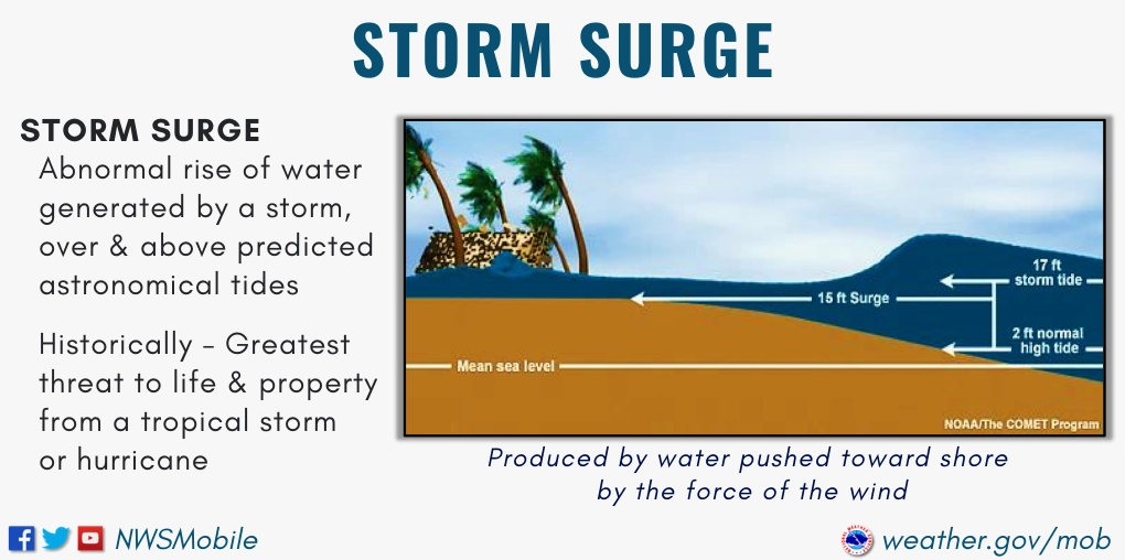
The progression from a tropical depression to a tropical storm, and potentially a hurricane, is a dynamic process. Each stage presents unique challenges for forecasters and requires specific communication strategies. Understanding these stages helps communities prepare for the associated weather hazards, such as heavy rainfall, storm surge, and high winds.
Factors Influencing Tropical Cyclone Intensity
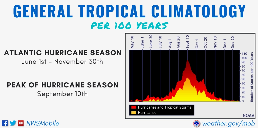
Several environmental factors influence whether a tropical depression intensifies into a tropical storm or hurricane. These include:
- Sea Surface Temperatures: Warm ocean waters (typically 80°F or higher) provide the necessary heat energy for intensification.
- Atmospheric Moisture: Abundant moisture in the mid-levels of the atmosphere fuels thunderstorm development.
- Vertical Wind Shear: Low vertical wind shear (change in wind speed and direction with height) allows the storm's structure to remain intact and organized.
- Upper-Level Outflow: Efficient outflow at the top of the storm helps vent heat and moisture, promoting further development.
The interaction of these factors determines the storm's potential for growth. A tropical depression in the Gulf, for example, may encounter conditions conducive to rapid strengthening due to the warm waters of the Gulf of Mexico.

Conversely, tropical depression Mirasol or other systems facing high wind shear might struggle to develop or could even weaken. The National Hurricane Center continuously monitors these conditions to provide accurate forecasts.
Tropical Cyclone Reports and Historical Context
Detailed reports on significant tropical events, such as tropical depression Wilma or tropical depression Basyang, provide invaluable data for improving forecasting models and understanding storm behavior. These historical analyses often highlight the transition points between different stages of tropical development.

Studying past storms, like those that formed from tropical depression rising into major hurricanes, helps meteorologists anticipate future threats. The ability to track and forecast systems like tropical depression 04w is a testament to advancements in meteorological science.
Preparing for Tropical Systems
While a tropical depression meaning implies the initial stage of a storm, it is crucial for coastal communities to remain vigilant. The transition to a tropical storm or hurricane can be rapid. Preparedness involves staying informed through official channels, developing an evacuation plan, and securing property against potential wind and water damage. Even weaker systems can cause significant disruptions through heavy rainfall and localized flooding.

The ongoing monitoring of tropical weather patterns ensures that timely warnings are issued. Forecasting the exact path and intensity of these systems remains a complex challenge, underscoring the importance of continuous meteorological research and data analysis.

The Ongoing Evolution of Tropical Forecasting
The science of tropical meteorology is constantly evolving. Advances in satellite technology, Doppler radar, and sophisticated computer models allow for increasingly accurate predictions of tropical cyclone development and track. This enhanced understanding is vital for issuing timely warnings and mitigating the impact of these powerful natural phenomena. By closely monitoring systems that begin as tropical depressions, forecasters aim to provide the public with the information needed to stay safe.
Comments (0)
No comments yet. Be the first to share your thoughts!
Leave a Reply
Your email address will not be published. Required fields are marked *