Understanding Arcus Clouds: The Menacing Shelf Cloud
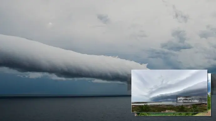
The sky, a canvas of ever-changing artistry, often presents phenomena that inspire awe and curiosity. Among these, the Arcus cloud, more popularly recognized as a shelf cloud, stands out with its dramatic and often foreboding appearance. These striking formations are not just visually impressive; they are key indicators of atmospheric processes at play, particularly those associated with thunderstorms.
Key takeaways about Arcus clouds:
- Arcus clouds, commonly known as shelf clouds, form along a gust front.
- They are associated with two main cloud types: Cumulonimbus and Cumulus.
- Their appearance often signals incoming wind and a potential drop in temperature.
- Arcus clouds are distinct from roll clouds, primarily by their attachment to the base of another cloud.
What is an Arcus Cloud?
An Arcus cloud is a low, horizontal, and often menacing cloud formation that is typically attached to the leading edge of thunderstorm outflow, commonly referred to as the gust front. The term 'Arcus' is Latin for arch, aptly describing its shape. These clouds are a visual representation of the turbulent air dynamics that occur when cooler, dense air from a storm's downdraft pushes outwards, displacing warmer, moist air ahead of it.
Formation and Characteristics of Shelf Clouds
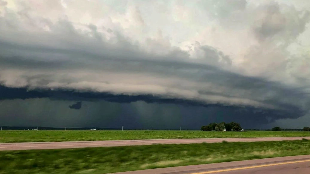
The genesis of a shelf cloud is intrinsically linked to the outflow boundary of a thunderstorm. As rain cools the air near the ground within a storm cell, this dense, cool air spreads outwards horizontally. When this outflow boundary collides with the warmer, more humid air in front of the storm, it forces the warm air upwards. This rapid ascent of moist air leads to condensation, forming the visible arcus cloud. The 'wedge' shape is characteristic, appearing to 'shelf' out from the base of the parent cloud.
Understanding the arcus shelf cloud phenomenon involves recognizing these key atmospheric interactions. The intensity of the updraft and the amount of available moisture significantly influence the shelf cloud's appearance, ranging from wispy and thin to thick and imposing.
Distinguishing Arcus Clouds from Roll Clouds
A common point of confusion for cloudspotters is differentiating between Arcus clouds and Volutus, more commonly known as roll clouds. While both are horizontal, tube-shaped clouds, a critical distinction lies in their detachment. An Arcus cloud, or shelf cloud, is always attached to the base of another cloud, typically a cumulonimbus or a developed cumulus cloud. In contrast, a roll cloud is detached and appears to roll along its horizontal axis, independent of any parent cloud base.
Types of Arcus Clouds
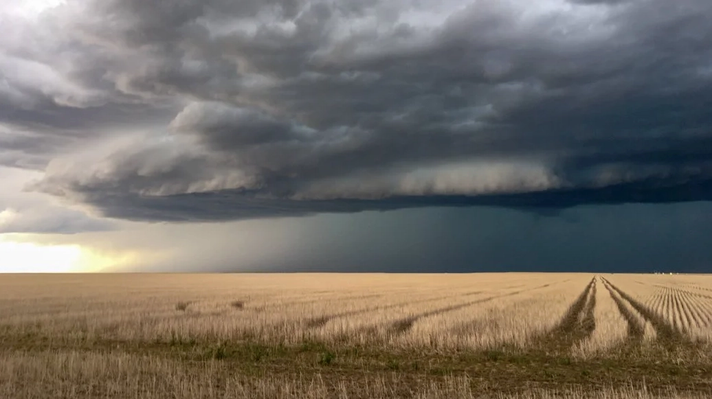
The Arcus cloud feature is primarily associated with two principal cloud types:
- Cumulonimbus (Cb): These are thunderstorm clouds, and the Arcus formations associated with them are often the most dramatic and indicative of severe weather. They are known as Cumulonimbus arcus (Cb arc).
- Cumulus (Cu): Less frequently, Arcus clouds can form along the gust fronts of well-developed Cumulus congestus clouds. These are termed Cumulus arcus (Cu arc).
Within these categories, specific subtypes exist, such as:
- Cumulonimbus arcus praecipitatio (Cb arc pra): An Arcus cloud associated with precipitation.
- Cumulonimbus arcus praecipitatio pannus (Cb arc pra pan): Characterized by ragged shreds of cloud below the main Arcus formation, often indicating heavier precipitation.
What to Expect When an Arcus Cloud Approaches
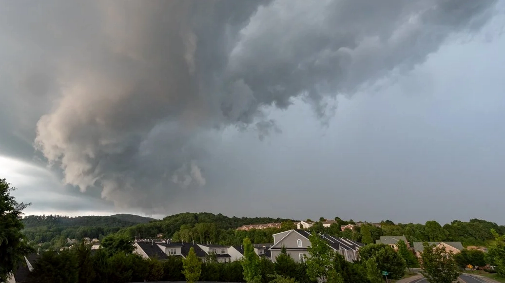
As an Arcus cloud, or shelf cloud, moves overhead, observers can anticipate several immediate weather changes. The most prominent are:
- Increased Winds: The gust front associated with the Arcus cloud brings a sudden increase in wind speed, often gusty and turbulent.
- Temperature Drop: The influx of cooler air from the storm's downdraft typically causes a noticeable decrease in temperature.
- Turbulent Sky: In the moments before the main precipitation arrives, the sky beneath the shelf cloud can appear dark and turbulent, sometimes described as a 'whale's mouth'.
While Arcus clouds are often part of storm systems that can produce damaging winds, they are generally not indicative of tornado formation. Their presence is more commonly associated with strong straight-line winds and heavy rain rather than tornadoes.
The Significance of Arcus Clouds in Meteorology
From a meteorological perspective, the arcus shelf cloud is a vital visual cue. It signifies the arrival of the thunderstorm's outflow boundary, marking the transition zone between the cooler, drier air of the outflow and the warmer, moist air ahead of the storm. Meteorologists use observations of Arcus clouds to understand storm structure, predict wind shifts, and forecast the onset of precipitation. The distinction between arcus cloud vs shelf cloud is minimal, as 'shelf cloud' is the widely accepted common name for the Arcus cloud formation.
For cloud enthusiasts and weather watchers, spotting an Arcus cloud is a thrilling experience, offering a direct glimpse into the powerful forces shaping our atmosphere.
Frequently Asked Questions About Arcus Clouds
Here are answers to some common questions regarding these fascinating cloud formations:
Are Arcus clouds dangerous?
While Arcus clouds themselves are not directly dangerous, they are associated with the gust front of thunderstorms, which can bring strong, gusty winds capable of causing damage. It is wise to take precautions when you see an approaching shelf cloud.
Can Arcus clouds occur without a thunderstorm?
Arcus clouds are most commonly associated with thunderstorms (Cumulonimbus). However, they can sometimes form with very large, well-developed Cumulus congestus clouds that are producing showers, though this is less common.
What is the difference between a shelf cloud and a wall cloud?
A shelf cloud is a low, horizontal, wedge-shaped cloud attached to the base of a cumulonimbus cloud, marking the gust front. A wall cloud, on the other hand, is a localized, persistent, and often abrupt lowering of cloud base within the rain-free base of a strong thunderstorm, and it is often associated with rotation and potential tornado development.
How high up are Arcus clouds usually found?
Arcus clouds form very close to the ground, typically appearing at the lowest levels of the atmosphere, directly above the gust front. They are considered low-level clouds.
Final Thoughts on Shelf Clouds
The Arcus cloud, or shelf cloud, is a spectacular meteorological phenomenon that offers valuable insights into storm dynamics. Its distinctive appearance serves as a visual warning of approaching winds and potential weather changes. By understanding its formation and characteristics, we gain a deeper appreciation for the intricate beauty and power of our atmosphere. Next time you witness this impressive cloud formation, you'll be better equipped to understand the weather story it tells.
Comments (2)
Meteorology Enthusiast
12:08:50 21-07-2026Storm Chaser 101
18:55:06 22-07-2026Leave a Reply
Your email address will not be published. Required fields are marked *