Understanding Landspouts: A Comprehensive Guide
Key Takeaways About Landspouts
Landspouts are a type of tornado that forms differently from traditional supercell tornadoes. They develop from ordinary thunderstorms, lack a rotating mesocyclone, and often form quickly with little warning. While generally weaker, they can still cause damage and require caution.
What is a Landspout and How Does it Differ from a Tornado?
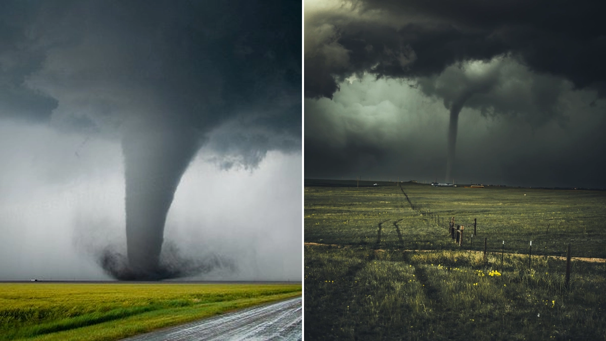
When severe weather strikes, the image of a tornado often conjures up powerful, destructive forces, reminiscent of cinematic depictions like Twister or the Wizard of Oz. These classic tornadoes descend from massive, rotating thunderstorms and are associated with tornado warnings due to their potential for significant damage. However, the atmospheric world presents a more nuanced picture, as evidenced by recent storms in Colorado, which have brought landspouts to public attention. A landspout tornado represents a less intense form of a tornado. Visually, it often appears as a slender rope extending from a cloud to the ground. While it can exhibit rapid spinning and may even lift dust or debris, it is typically weaker and has a shorter lifespan compared to the tornadoes observed during major severe weather outbreaks.
The fundamental distinction lies in their formation process. Traditional tornadoes typically form from mesocyclones, which are rotating updrafts within supercell thunderstorms that are readily detectable on radar. In contrast, landspouts originate from ordinary, non-rotating thunderstorms, often forming along weather boundaries like outflow boundaries or drylines. This difference in origin means that landspouts usually form quickly near the surface and may not present the characteristic warning signatures on radar that forecasters use to detect more severe tornadoes.
The Formation Process of a Landspout
Landspouts commonly develop on hot, dry days characterized by atmospheric instability and the presence of thunderstorms overhead. Crucially, they lack the rotating core, or mesocyclone, that powers more dangerous tornadoes. The process begins with low pressure at the surface, which creates rising air. As this air rushes in to fill the low-pressure area, it enhances circulation and begins to rise further. When a thunderstorm develops above this nascent circulation, the storm's updraft stretches the developing vortex vertically towards the cloud base. This stretching action tightens the rotation, much like an ice skater pulling their arms in to spin faster, ultimately creating the visible landspout tornado. The storm can then pick up dust and debris from the ground, giving it a tornado-like appearance. Eventually, the landspout formation is often terminated when it draws in cooler air, which disrupts and kills the circulation.
Landspout Formation in Colorado
The event in Franktown, Colorado, serves as a recent example of a landspout causing damage. These occurrences can happen with little prior warning, a characteristic common to many landspout events. Unlike the tornadoes born from easily detectable mesocyclones, landspouts emerge from ordinary thunderstorms along specific weather boundaries. Their rapid formation near the ground often means they evade typical radar detection methods.
Understanding Landspout Characteristics
Landspouts can materialize within cumuliform clouds even when the parent cloud itself is not rotating. Their typical formation occurs along a weather boundary where air converges under conditions of weak vertical rotation. This convergence forces the air upward, initiating cloud formation. The updraft then stretches this rotation, intensifying its spin. While often described as summer-time thunderstorms, tornadoes can indeed form from these systems. Their visual appearance is typically slender and snake-like, and they are more frequently observed in regions like eastern Colorado, Wyoming, and New Mexico, where cloud bases tend to be higher.
A significant difference from supercell tornadoes is the absence of a Rear Flank Downdraft (RFD) associated with landspouts. Despite not originating from supercells, it is critical to recognize that landspouts can still be powerful phenomena, capable of producing damage equivalent to EF-2 and EF-3 on the Enhanced Fujita scale. Therefore, even though a landspout is generally considered weaker than its supercell counterpart, it must still be treated with the same level of caution and respect as any tornado if observed.
The term "landspout" itself was introduced by atmospheric scientists in the 1980s to describe vortices associated with thunderstorms that do not possess a significant mid-level mesocyclone. A mesocyclone is a cyclonically rotating vortex, typically 2 to 10 kilometers in diameter, within a convective storm, and it is the engine for strong tornadoes. Landspouts are generally short-lived, often lasting less than 15 minutes, and have a limited track length. They can develop under rapidly forming cumuliform clouds, along surface boundaries, or at the intersection of multiple boundaries. Because their rotation originates at low levels in the atmosphere, the resulting vortex does not extend significantly high into the cloud. In essence, landspouts form from a ground-level circulation that is drawn upward into a storm, whereas traditional tornadoes form from the rotating supercell thunderstorm itself, reaching down from the cloud.
Landspout vs. Dust Devil: Key Differences
It is important to distinguish a landspout from a dust devil. While both are rotating columns of air, their formation mechanisms and environments are quite different. Dust devils form on clear, sunny days due to intense surface heating, creating a strong updraft that causes near-surface rotation. They are not associated with thunderstorms and are generally much weaker and shorter-lived than landspouts. A landspout, as discussed, is directly linked to thunderstorm activity and draws its energy from the storm's updraft.
Waterspouts: The Marine Counterpart
Similar in nature to landspouts are waterspouts, which are essentially tornadoes occurring over water. Some waterspouts develop from supercell thunderstorms and can be as destructive as land-based tornadoes if they move ashore. Others, known as fair-weather waterspouts, form more rapidly beneath developing cumulus clouds. While typically less violent and destructive than their supercell-born counterparts, fair-weather waterspouts can still generate winds exceeding gale force, posing a significant risk to small watercraft by potentially swamping or capsizing them.
Safety Considerations for Landspouts
Even though landspouts are typically weaker than strong tornadoes, they are still classified as tornadoes. This classification underscores the importance of taking them seriously. If you witness a funnel cloud forming in your area, regardless of its apparent intensity, it should be treated as a tornado. Seek shelter immediately in a sturdy building, preferably in an interior room on the lowest floor, away from windows.
Unlike classic tornadoes that often have detectable radar signatures due to their mesocyclone origins, landspout warning capabilities are more limited. Their formation is often rapid and near the surface, making them harder to predict with current technology. This lack of advanced warning necessitates heightened situational awareness when weather conditions are conducive to landspout development, particularly in areas prone to their occurrence, such as eastern Colorado.
Expert Insights on Landspout Phenomena
Professors Steve Ackerman and Jonathan Martin from the University of Wisconsin-Madison's department of atmospheric and oceanic sciences have provided valuable insights into weather phenomena. Their expertise highlights the complexities of storm dynamics. Landspouts, defined by the American Meteorological Society's glossary as colloquial terms for small tornadoes whose vorticity originates in the boundary layer and whose parent cloud is in its growth stage, exemplify these complexities. Their occurrence relies on colliding surface winds generating a vortex, which is then intensified and lifted by a developing thunderstorm's updraft.
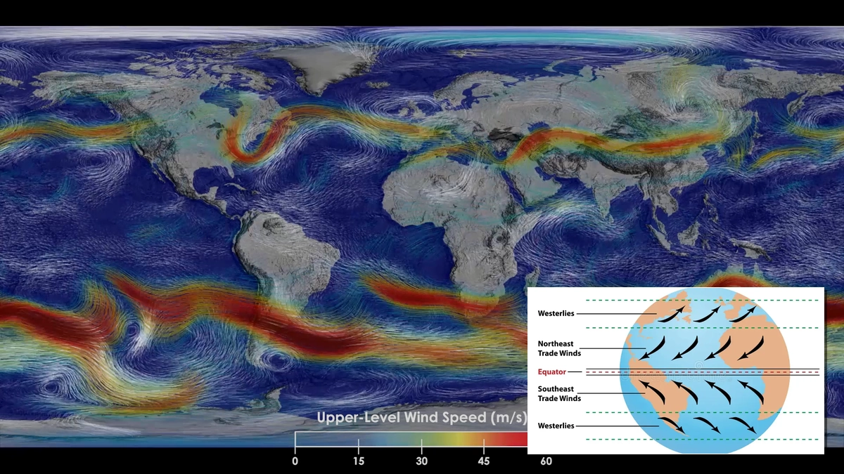
The key difference remains the energy source and formation mechanism. Tornadoes can tap into powerful energy sources like the jet stream, far exceeding ground-level energies. Their rotation begins at cloud level and is detectable via Doppler radar. Landspouts, conversely, form at the ground and are often below the radar beam, rendering them undetectable by conventional means. This underscores the importance of visual identification and immediate safety precautions when conditions are favorable for landspout development.
Conclusion: Preparedness is Key
While the spectacle of a landspout might seem less intimidating than that of a powerful supercell tornado, its potential to cause damage cannot be overlooked. Understanding the unique formation processes, the difference between landspouts and dust devils, and the limitations in predicting landspout events are crucial for public safety. Always treat any observed funnel cloud or rotating column of air with extreme caution and seek appropriate shelter. Staying informed about local weather conditions and heeding any available warnings are the best strategies for personal protection against these formidable, yet often elusive, weather phenomena.
 21/07/2026