Understanding Funnel Clouds: Formation, Characteristics, and Safety
What is a Funnel Cloud?
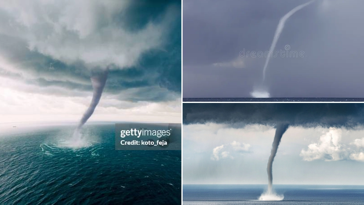
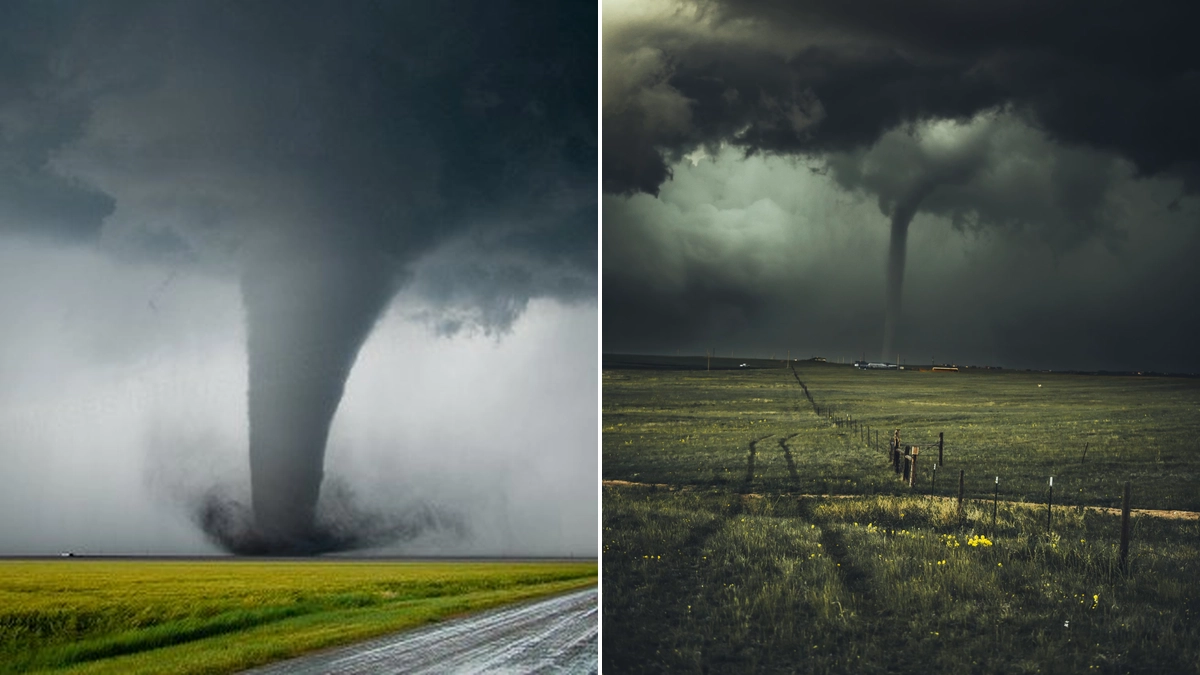
A funnel cloud is a recognizable condensation funnel that extends downward from the base of a towering cumulus or cumulonimbus cloud. It is inherently associated with a rotating column of air. Crucially, a funnel cloud is distinct from a tornado because it is not in contact with the ground. If this rotating column of air makes contact with the ground, or if a debris cloud or dust whirl is visible beneath it, it is then classified as a tornado.
The presence of a funnel cloud often indicates potentially severe weather conditions are developing. While not all funnel clouds develop into tornadoes, they serve as a visible warning sign that conditions conducive to tornado formation might be present. Meteorologists monitor these phenomena closely to issue timely warnings.
Funnel Cloud Formation: The Science Behind the Phenomenon
The formation of funnel clouds is a complex process involving specific atmospheric conditions. It typically begins with the development of a strong updraft within a thunderstorm. This updraft can cause air to rotate, forming a mesocyclone within the storm cloud. As this rotating column of air extends downward, it can entrain cooler, moist air from the surrounding environment.
When the pressure within this rotating column drops significantly, the air cools to its dew point. This cooling causes water vapor to condense, making the rotating column visible as a funnel cloud. The intensity of the rotation and the stability of the atmosphere play critical roles in whether this visible funnel reaches the ground and becomes a tornado.
Conditions conducive to funnel cloud formation include:
- Presence of strong updrafts within thunderstorms.
- Atmospheric instability allowing for rapid upward movement of air.
- Wind shear, which causes winds at different altitudes to blow at different speeds or directions, promoting rotation.
- Specific temperature and moisture profiles in the atmosphere.
Cold Air Funnels
Cold air funnels are a specific type of funnel cloud that forms under different conditions. They typically develop beneath showers or weak thunderstorms when the air aloft is exceptionally cold. This scenario is most common in the fall and spring when the sun heats the lower atmosphere, creating convection and showers, but temperatures at altitudes of 15,000 to 20,000 feet remain very cold.
Cold air funnels are generally considered harmless. However, on rare occasions, they can touch down and cause minor tornado damage, typically classified as EF-0 (winds up to 85 mph). Observing temperatures aloft during a cold air funnel event, like the one that occurred in Missouri on September 25, 1994, reveals pools of very cold air at high altitudes, often indicated by blue and purple colors on weather maps.
Funnel Cloud vs. Tornado: Key Distinctions
The primary difference between a funnel cloud and a tornado lies in their interaction with the ground. A funnel cloud is a rotating condensation funnel that extends from a cloud but does not reach the surface. A tornado, conversely, is defined by its contact with the ground. This contact can manifest in two ways:
- The condensation funnel itself is in physical contact with the ground.
- A visible swirl of dust and debris is present on the ground beneath the condensation funnel, indicating that the rotating column is affecting the surface.
It is essential to understand this distinction for safety. While a funnel cloud may not be causing direct damage, its presence signifies a severe weather threat. A tornado, however, is an active destructive threat that requires immediate shelter.
When to Issue a Funnel Cloud Warning
A funnel cloud warning is issued by meteorological services when a funnel cloud has been visually confirmed or indicated by radar signatures of strong rotation within a storm that is lowering towards the ground. These warnings are crucial for alerting the public to an imminent threat of a tornado.
When a funnel cloud warning is issued for your area, it is imperative to take immediate action:
- Seek Shelter Immediately: Move to the lowest level of a sturdy building, such as a basement or storm cellar.
- Stay Away from Windows: Ensure you are in an interior room, away from windows and doors.
- Stay Informed: Monitor weather alerts through reliable sources like NOAA Weather Radio or local news.
Radar can detect rotation within a storm, which can indicate the potential for a funnel cloud or tornado. Doppler radar technologies are instrumental in identifying mesocyclones and the lowering of storm bases that often precede funnel cloud formation.
Safety Measures During Funnel Cloud and Tornado Threats
The primary goal during a severe weather event involving funnel clouds or tornadoes is to ensure personal safety. Understanding the difference and the potential progression is key.
For Funnel Clouds:
- Be vigilant and aware of your surroundings.
- Note the direction of movement if visible and heed any warnings issued.
- Prepare to take shelter if the funnel cloud appears to be intensifying or moving towards populated areas.
For Tornadoes (once a funnel cloud touches down or is confirmed as a tornado):
- Go to your safe place: The safest place is a basement, storm cellar, or an interior room on the lowest floor of a sturdy building, away from windows.
- Protect yourself: Cover your head and neck with your arms or any available protective item (e.g., mattress, blanket).
- In a vehicle or mobile home: Evacuate immediately and seek shelter in a substantial building or a ditch. Do not try to outrun a tornado in a car in urban or heavily wooded areas.
- In open country: Lie down in a ditch or other depression and cover your head.
Historical Context and Data:
| Event Description | Date | Location | Type |
|---|---|---|---|
| Cold air funnel event observed | September 25, 1994 | Missouri, USA | Cold air funnel (potential EF-0 damage) |
| Funnel cloud sighting during severe storms | Monday (Specific date not provided) | Fannin County, Texas, USA | Funnel cloud (associated with damaging storms) |
The Science of Storms: Further Insights
The study of funnel clouds and tornadoes falls under the broader umbrella of severe weather research. Understanding atmospheric dynamics, including wind patterns, pressure systems, and temperature gradients, is vital for forecasting these events. Advanced radar technologies, like Doppler radar, provide crucial data by detecting the speed and direction of precipitation and air movement within storms, allowing meteorologists to identify rotational signatures indicative of funnel cloud and tornado development.
The information gathered from past events, such as the temperature aloft maps from September 25, 1994, helps refine forecasting models. Continuous research and data collection are essential for improving warning systems and ultimately saving lives. Stay informed about weather conditions in your area, especially during seasons prone to severe storms.
Staying Prepared for Severe Weather
Preparation is key when it comes to severe weather. Having a family emergency plan that includes designated shelter areas and communication methods is highly recommended. Familiarize yourself with local emergency alert systems and ensure you have a weather radio. Knowing the difference between a funnel cloud and a tornado, and understanding the appropriate actions for each, can make a critical difference in safety.
 21/07/2026