Understanding Squalls A Comprehensive Guide to Meteorological Phenomena

What is a Squall? Understanding the Dynamics of Rapid Wind Shifts
A squall is a fascinating and often abrupt atmospheric event characterized by a significant and sudden variation in wind speed. Unlike a typical gust, a squall begins suddenly, lasts for a brief period, typically on the order of minutes, and then dissipates just as quickly. This phenomenon is often accompanied by a shower or even a thunderstorm, adding to its dynamic nature. The World Meteorological Organization (WMO) defines a squall as an atmospheric phenomenon where wind speed increases rapidly, is sustained, and then decreases suddenly.
Defining a Squall Meteorological and Nautical Perspectives
Meteorologists and mariners often define squalls with specific criteria to ensure accurate reporting and understanding. The National Oceanic and Atmospheric Administration (NOAA) National Weather Service, for instance, describes a squall as a strong wind event where speed increases to at least 16 knots and is sustained at 22 knots or more for a minimum of one minute. In nautical contexts, a squall is considered a severe local storm encompassing winds, cloud masses, and any accompanying precipitation, thunder, or lightning.
Further refining the definition, the American Meteorological Society notes that in U.S. observational practice, a squall is officially reported only if wind speeds of 16 knots or higher are sustained for at least two minutes, distinguishing it clearly from a mere gust. This precision is crucial for safety, especially in marine operations and aviation.
Types of Squalls and Their Distinct Characteristics
Squalls manifest in various forms, each with unique triggers and impacts:
- Lake Effect Snow Squall: This localized, intense band of moderate to heavy snowfall can travel considerable distances inland, sometimes persisting for many hours. It is often accompanied by strong, gusty surface winds and can produce significant snow accumulations, potentially 6 inches or more in 12 hours.
- Pre-Frontal Squall Line: A line of thunderstorms that typically precedes an advancing cold front, signaling a shift in weather patterns.
- Pre-Hurricane Squall Line: Often one of the first indicators of an approaching hurricane, this is usually a straight line of storms resembling a mid-latitude squall line. It can appear significantly ahead of the main hurricane bands, sometimes hundreds of miles from the eye.
- Snow Squall: Defined as an intense but short-lived period of moderate to heavy snowfall, accompanied by strong, gusty surface winds and possibly lightning. Significant snow accumulation is common.
- Squall Line: A more general term for a line of active thunderstorms, which may be continuous or have breaks, and includes areas of precipitation associated with these storms.
The Science Behind Squalls Drivers and Formation
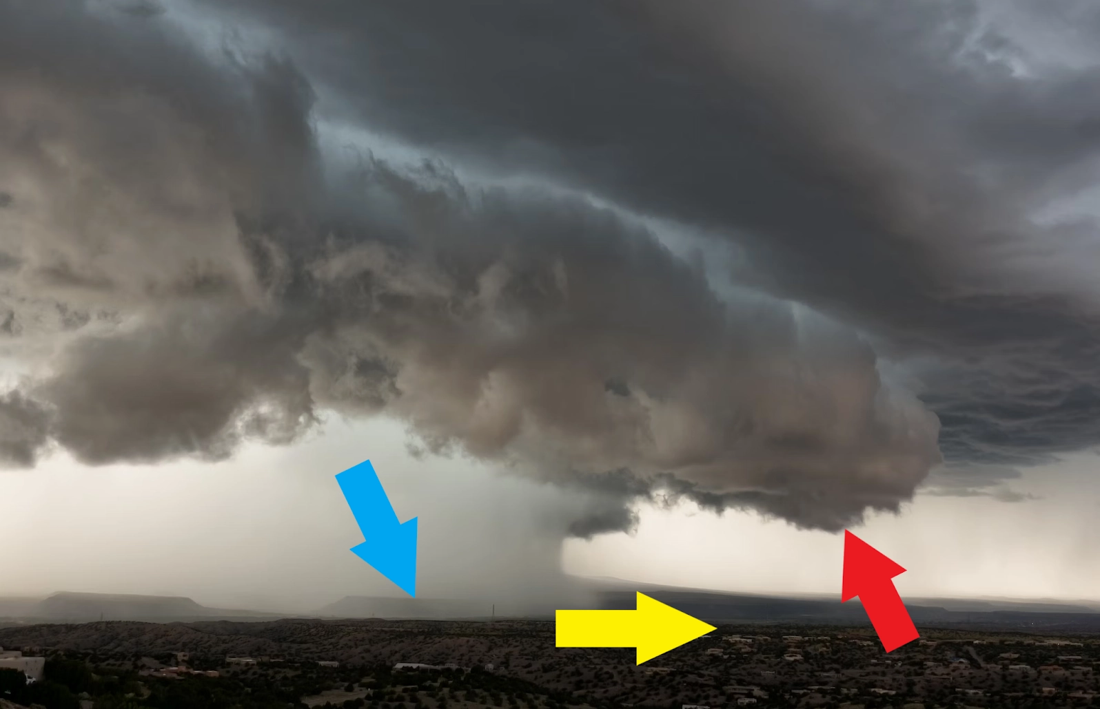
Squalls are fundamentally linked to thunderstorms. They occur when atmospheric instability, combined with lifting mechanisms such as cold fronts or convective heating, leads to the rapid development of cumulonimbus clouds. The sudden onset and rapid intensification of winds within a squall are driven by the downdrafts within these thunderstorms. As precipitation falls and evaporates, it cools the air, making it denser and causing it to plunge towards the surface. This powerful downdraft spreads out upon impact, creating the characteristic strong, gusty surface winds associated with a squall.
Impacts and Risks Associated with Squalls
The sudden and unpredictable nature of squalls presents several risks:
Marine Operations: Squalls pose a significant threat to marine activities, as they can rapidly change sea conditions from calm to hazardous. Unexpectedly strong winds and rough seas can endanger vessels and crews.
Human Health: Direct impacts include injuries or fatalities from the force of the wind, flying debris, or falling trees. Indirect effects, such as those experienced during storm preparation or cleanup, can lead to falls, lacerations, or other injuries. Power outages resulting from squalls can also lead to secondary dangers like electrocution or carbon monoxide poisoning from generators.
Aviation: Sudden wind shear associated with squalls can create dangerous conditions for aircraft, especially during takeoff and landing.
General Safety: Squalls can cause power outages, disrupt transportation, and damage property due to high winds.
Squall vs. Microburst Distinguishing Between Similar Phenomena
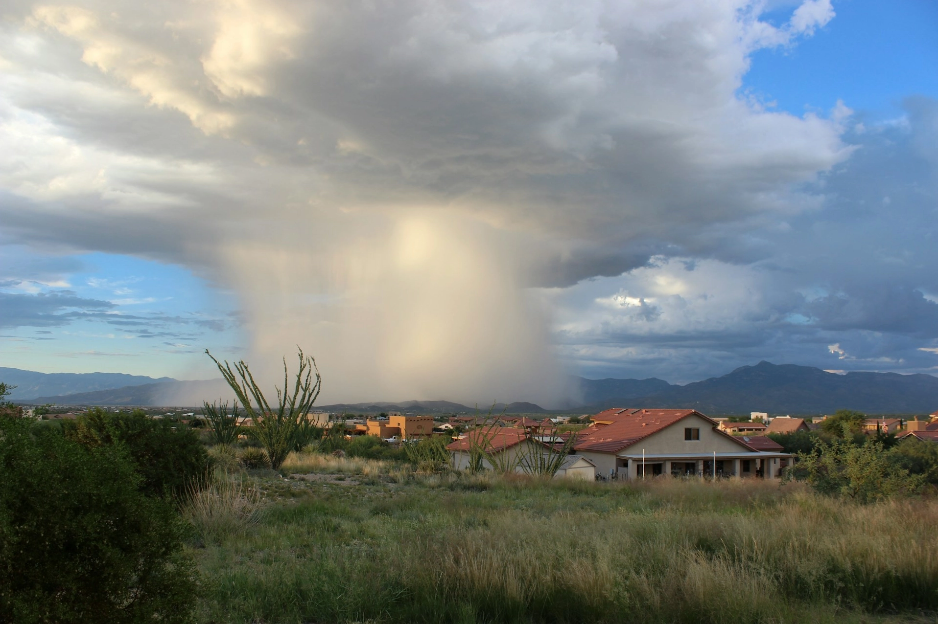
While both squalls and microbursts involve strong winds, they differ significantly in scale and duration. A microburst is a small-scale, intense downdraft from a thunderstorm that lasts only a few minutes and covers a very limited area. Its winds are divergent, spreading out from the point of impact.
A squall, on the other hand, is typically associated with a larger weather system, such as a squall line or a snow squall, and can cover a more extensive area. The WMO definition emphasizes a variation in wind speed over a short duration, often minutes, while NOAA and AMS definitions focus on sustained high wind speeds meeting specific criteria. The distinction is crucial for forecasting and reporting weather events accurately.
Preparedness and Management of Squall Risks
Given the unpredictable nature of squalls, preparedness is key. Understanding weather forecasts and warnings is the first step. For those in areas prone to snow squalls, having emergency supplies ready is advisable. For marine activities, constant monitoring of weather conditions and heeding any storm warnings is critical. The Sendai Framework for Disaster Risk Reduction highlights the importance of understanding and mitigating risks associated with various natural hazards, including those related to severe weather events like squalls.
Engaging with the Concept of Squalls
The study of weather phenomena like squalls is continuous, with ongoing research seeking to refine our understanding and predictive capabilities. While specific numerical limits for all squall types may not always be available, the general drivers and impacts are well-documented. The relationship between squalls and thunderstorms underscores the interconnectedness of atmospheric processes.
It is interesting to note how terms evolve, and how concepts like the squall meaning can differ slightly between scientific and popular usage. For instance, in popular culture, 'squall' might be referenced in different contexts, such as the character Squall Leonhart from Final Fantasy VIII, known for wielding his iconic gunblade, or the general concept of a sudden intense event. However, in meteorology, the focus remains on the defined atmospheric conditions.
Adapting to Squall Events
Living with the possibility of squalls requires a proactive approach to safety. Whether it's understanding the difference between a squall line and a less severe weather event, or preparing for the impacts of a lake effect snow squall, knowledge is empowerment. Continuous monitoring and adherence to safety guidelines remain paramount for mitigating the risks posed by these powerful, albeit brief, atmospheric events.
Comments (0)
No comments yet. Be the first to share your thoughts!
Leave a Reply
Your email address will not be published. Required fields are marked *