Understanding Freezing Rain and Its Impact
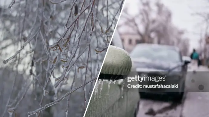
Freezing rain, a perilous form of winter precipitation, poses significant threats across various sectors. Its occurrence is dictated by a delicate atmospheric balance, where liquid raindrops descend through a sub-freezing layer of air near the ground. This unique meteorological phenomenon can lead to hazardous conditions, making travel treacherous and infrastructure vulnerable.
Key Takeaways on Freezing Rain:
- Forms when supercooled raindrops freeze on contact with surfaces below freezing.
- Distinguished from sleet by the absence of prior freezing in the air.
- Impacts travel, infrastructure, and can lead to dangerous ice accumulation.
- Climate change may alter its frequency and intensity in various regions.
The Science Behind Freezing Rain Formation
The genesis of freezing rain, alongside sleet, lies in the same fundamental atmospheric process. It begins with raindrops forming in a warm layer of air well above the surface. As these liquid drops descend, they encounter a shallow layer of freezing air just above the ground. The critical difference between freezing rain and sleet hinges on the thickness of this sub-zero layer. In the case of freezing rain, this layer is so thin that the raindrops do not have sufficient time to freeze before reaching the ground. Consequently, upon contact with surfaces that are at or below freezing, the liquid water instantaneously solidifies, creating a glaze of ice.
Sleet, conversely, forms when the freezing layer of air is sufficiently thick. This allows the falling raindrops to freeze into ice pellets before they strike the ground. Understanding the distinction between freezing rain and sleet is crucial for accurate weather forecasting and public safety advisories.
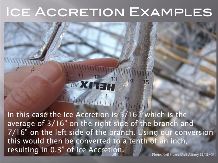
Understanding Freezing Rain Events
Freezing rain events carry substantial and often dangerous implications for nearly every aspect of a region's infrastructure and daily life. The frequency with which these events occur is not uniform and varies significantly depending on geographical location. In the more southerly and warmer portions of the Great Lakes region, for instance, there has been a noticeable decline in the occurrence of freezing rain events. This trend is closely linked to regional warming patterns.
As the climate continues to warm, the traditional rain-snow line is projected to shift northward on average. This shift means that areas historically accustomed to reliable snowfall might increasingly experience freezing rain. The warming climate also contributes to storms carrying more atmospheric moisture, increasing the likelihood of record-breaking ice accumulations. This phenomenon necessitates a reassessment of preparedness strategies in regions that may not have traditionally been considered high-risk for severe freezing rain.
Atmospheric Conditions Favoring Freezing Rain
Several distinct atmospheric patterns can precipitate freezing rain events, each characterized by a specific set of conditions:
- Cold Air Damming: This occurs when cold air becomes trapped in low-lying valleys or against mountain ranges, such as the Appalachian Mountains. When warm, moist air flows over this trapped cold air mass, it can lead to the formation of freezing rain. An easterly flow from the Atlantic Ocean is a common contributor to cold air damming along the Appalachian chain, forcing warmer air aloft to override the colder surface air.
- Frontal Occlusion: In certain scenarios, a cold front can overtake a warm front, a process known as frontal occlusion. This can effectively trap cold air near mountainous terrain, creating conditions conducive to freezing rain when warmer air moves in above it.
- Valley Inversions: Low-lying valleys are naturally prone to retaining cold air. When warm, moist air moves into these areas, it can create a temperature inversion where temperatures are colder near the ground and warmer at higher altitudes, facilitating the freezing rain process.
The figure provided by the Northwest Indiana Weather Forecasting Office illustrates how different types of precipitation form, offering a visual aid to understanding these complex processes.
The Significant Importance of Freezing Rain Events
The impact of freezing rain events cannot be overstated, primarily due to the insidious nature of the ice they create. This layer of ice, often invisible to the naked eye, forms on roadways, sidewalks, airport runways, and other surfaces, rendering them extremely hazardous. Travel becomes exceptionally dangerous, increasing the risk of accidents and making emergency response efforts more challenging.
Beyond transportation, the accumulated weight of ice on trees and power lines can lead to widespread power outages. Downed trees can block roads and damage property. The economic impact is substantial, affecting businesses, agriculture, and public services. Understanding the freezing rain meaning and its potential consequences is vital for communities in affected areas.
Regional Variations and Climate Change Influence
The frequency and intensity of freezing rain events exhibit considerable regional variation. While some areas, particularly warmer southern regions like parts of the Great Lakes, are seeing a decrease in these events, others may experience an increase. Climate change is a significant factor influencing these trends. As global temperatures rise, atmospheric conditions conducive to heavy precipitation may become more common, even in regions that historically experienced less freezing rain.
This projected shift means that areas previously known for consistent snowfall might need to prepare for more frequent freezing rain. The increased moisture content in a warmer atmosphere can lead to record-breaking ice accumulations. Awareness of a freezing rain warning for specific regions, such as Saskatchewan, Montreal, or Ottawa, becomes critical during winter months. Staying informed about localized conditions, including freezing rain versus snow events, is paramount for safety.
Preparing for and Responding to Freezing Rain
Given the severe implications of freezing rain, proactive preparation and effective response are essential. Communities and individuals should:
- Monitor Weather Alerts: Stay updated on freezing rain warnings and advisories issued by meteorological services.
- Prepare for Power Outages: Have emergency kits ready with essentials like flashlights, batteries, non-perishable food, and water. Ensure backup heating options are available if necessary.
- Ensure Safe Travel: Avoid unnecessary travel during freezing rain events. If travel is essential, drive slowly, maintain a safe distance from other vehicles, and ensure your vehicle is equipped for winter conditions.
- Secure Property: Trim trees that could pose a risk to power lines or structures. Ensure outdoor items are secured.
By understanding the nature of freezing rain and implementing appropriate safety measures, individuals and communities can mitigate the risks associated with these dangerous winter weather events.
The Future of Freezing Rain in a Changing Climate
Projected changes in climate suggest a complex future for freezing rain. While some regions may see a decline, others could experience an increase in frequency and intensity. The potential for record-breaking accumulations due to increased atmospheric moisture is a significant concern. This evolving climate landscape underscores the need for continuous research and adaptation strategies to address the ongoing challenges posed by freezing rain and other extreme weather phenomena.
Comments (1)
Alice Chen
15:31:40 21-07-2026Leave a Reply
Your email address will not be published. Required fields are marked *