Understanding Foehn and Chinook Winds: A Comprehensive Analysis
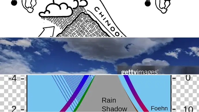
The dynamic interplay of geography and atmospheric conditions gives rise to unique weather patterns, among which Foehn and Chinook winds stand out. These warm, dry downslope winds, often experienced on the leeward side of mountain ranges, significantly influence local climates and ecosystems. Understanding their formation and characteristics is crucial for meteorologists, residents, and anyone interested in the forces shaping our planet's weather.
- Foehn winds are a general term for warm, dry downslope winds occurring on the leeward side of mountain barriers.
- Chinook winds are a specific regional type of Foehn wind experienced east of the Rocky Mountains.
- Both phenomena result from air descending a mountain slope, undergoing adiabatic warming and drying.
- Associated phenomena include Chinook Arches, lee waves, hydraulic jumps, and breaking waves, each with distinct atmospheric implications.
The Science Behind Foehn and Chinook Winds
At its core, the formation of Foehn and Chinook winds is explained by the Föhn Effect. This process begins when moist air encounters a mountain range, forcing it to rise. As the air ascends the windward side, it cools adiabatically, leading to condensation and precipitation. This process releases latent heat, warming the air slightly even as it rises.
Upon reaching the mountain crest, the air, now significantly drier, descends the leeward side. As it falls, it warms adiabatically at a rate of approximately 10°C per kilometer. This rapid warming, coupled with the initial drying on the windward side, results in exceptionally warm and dry conditions in the valleys and plains below.
Distinguishing Foehn from Chinook
While 'Foehn' is the general term for this meteorological process, 'Chinook' refers specifically to the Foehn wind found in the interior of North America, particularly east of the Rocky Mountains. The term 'Chinook' was originally associated with coastal winds but is now predominantly used for the downslope winds east of the Rockies in regions like Alberta, Canada, and the Great Plains of the United States. The confusion often arises because the same large-scale airflow across the Rockies can produce vastly different weather conditions simultaneously: rain on the Pacific Northwest coast, snow on the windward side of the Rockies, and a warm Chinook on the leeward side.
Associated Atmospheric Phenomena
The flow of air over mountain barriers, as seen with Foehn and Chinook winds, can create several fascinating atmospheric phenomena:
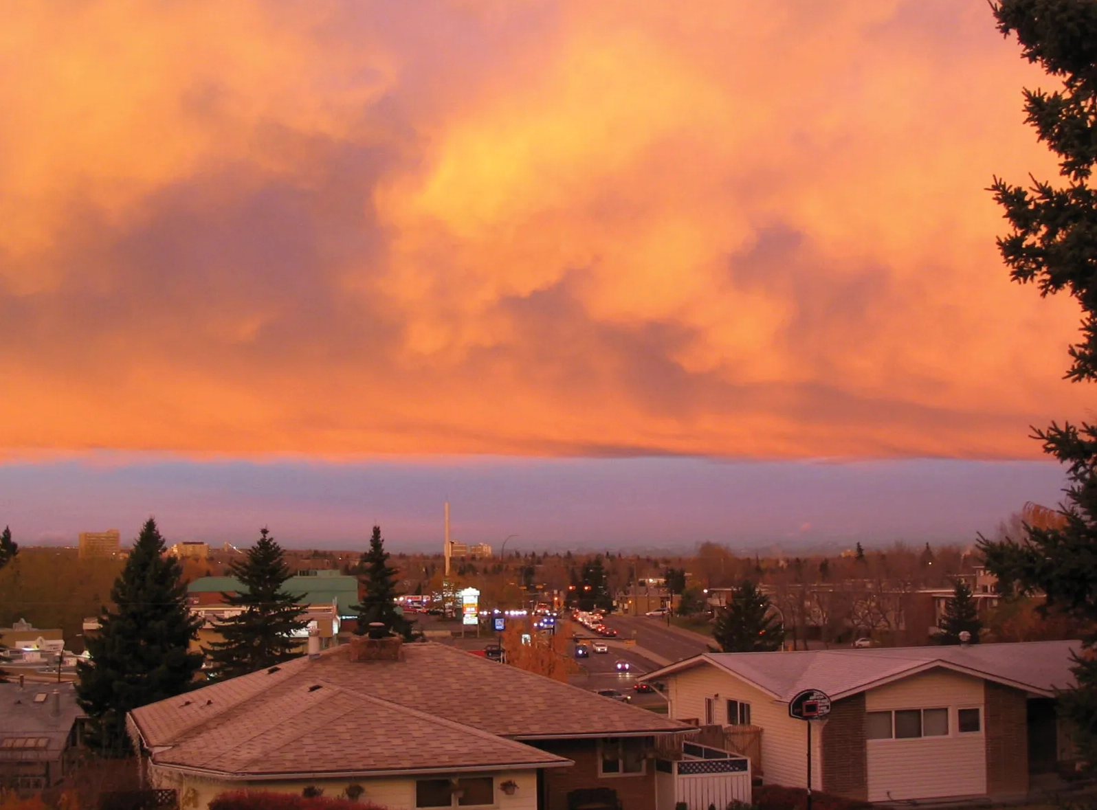
- Chinook Arch: A distinctive cloud formation appearing as a bank of altostratus clouds east of the Rockies. It heralds the approach of a Chinook wind and forms in the rising portion of standing waves on the lee side of the mountains. An observer below might see an arch of clear air between the cloud and the mountains.
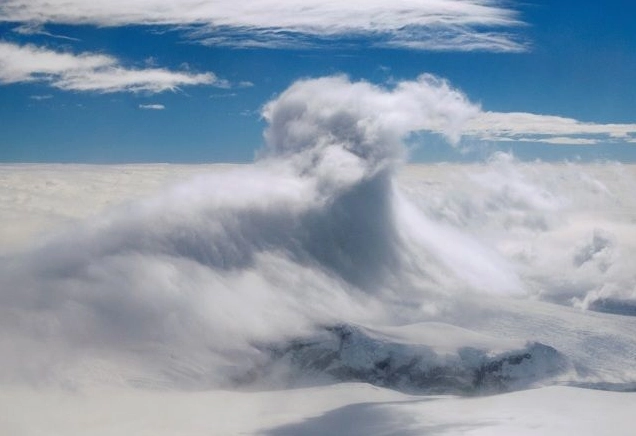
- Lee Waves: These form as stable air flows over a mountain barrier. They can manifest as lenticular clouds (altocumulus lenticularis) at the crest of the waves, often appearing stationary despite strong winds.
- Hydraulic Jump: Occurs when the cross-mountain flow is very strong and a stable layer, like an inversion, is present just above the mountaintop. This can lead to a 'shooting flow' down the lee side, creating rotors and severe low-level turbulence.
- Breaking Waves: Similar to ocean waves crashing ashore, these can occur above the inversion layer over the mountaintop, generating severe turbulence and influencing the shooting flow on the leeward side.
Characteristics and Impacts of Chinook Winds
Chinook winds, specifically, are known for their dramatic temperature and humidity changes. Air descending from the Rockies can warm by 27 to 36 degrees Fahrenheit (15 to 20 degrees Celsius) by the time it reaches the plains. Relative humidity can plummet below 10%, leading to rapid snowmelt (sometimes referred to as 'disappearing' snow) and increased fire danger during dry periods. These winds can be sustained at high speeds, sometimes exceeding 100 knots in localized areas like Boulder, Colorado.
Forecasting Chinooks requires specific conditions:
- A stable layer upstream of the mountain barrier, about 1-2 kilometers above the mountaintop.
- A strong surface pressure gradient across the barrier, typically with high pressure over the Pacific or Great Basin and low pressure on the Great Plains.
- Strong westerly winds near the mountaintop (around 700 mb). Interestingly, a strong jet stream is not always necessary, as it can disrupt the wave structures needed for downslope winds.
Other Notable Downsloping Winds
While Chinooks are prominent, other regional downslope windstorms exist:
- Santa Ana Winds: These occur in southern California, characterized by an easterly component. Though not as strong as some Colorado Chinooks, they can gust to nearly 100 knots and exacerbate wildfire conditions due to extreme dryness. They are associated with high pressure over the Great Basin and a strong pressure gradient over southern California's mountains.
- Katabatic Winds: These are cold, dry downslope winds originating from ice sheets on elevated plateaus or glaciers, such as in Antarctica and Greenland. Driven by gravity as cold, dense air spills over edges, they can exceed 100 knots and create 'ground blizzards' if loose snow is present.
Forecasting and Understanding Mountain Winds
Predicting these powerful winds involves analyzing surface pressure gradients, upper-air wind patterns, and the presence of stable atmospheric layers. For instance, forecasting Chinooks involves observing conditions like a stable layer 1-2 km above mountaintops and strong westerly flow around the 700 mb level. The presence or absence of precipitation on the windward side is also a key factor, as it influences the amount of latent heat released and thus the final temperature on the leeward side.
Conclusion: The Power of Mountain Winds
Foehn and Chinook winds are potent meteorological phenomena driven by the interaction between air masses and mountainous terrain. Their ability to dramatically alter temperature, humidity, and wind speed makes them significant factors in local weather patterns, influencing everything from snowmelt and fire risk to aviation safety. Continued study and accurate forecasting of these winds are essential for communities living in mountainous regions worldwide.
Comments (2)
Alice Johnson
10:00:25 21-07-2026Bob Williams
16:11:41 22-07-2026Leave a Reply
Your email address will not be published. Required fields are marked *