Understanding Dust Devils: Formation, Characteristics, and Occurrence
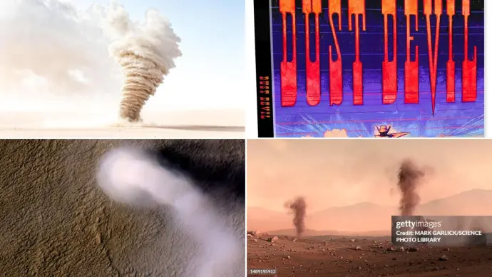
Dust devils are intriguing atmospheric vortices that capture the attention of many. These rotating columns of air, often filled with dust and debris, are a common sight in arid and semi-arid regions worldwide. While visually similar to tornadoes, they are fundamentally different in their formation and intensity. Understanding what a dust devil is, how it forms, and its typical characteristics is key to appreciating these natural phenomena.
Key Dust Devil Characteristics
- Size: Diameters typically range from 10 to 300 feet, with heights from 500 to 1000 feet, though some can be much larger.
- Intensity: Generally less intense than tornadoes, but can still cause localized damage.
- Duration: Usually last a few minutes, but can persist for over an hour in specific conditions.
- Formation: Caused by strong surface heating under clear skies and light winds.
What Exactly is a Dust Devil?
A dust devil, also known as a sand devil, is a small, brief whirlwind. These phenomena are most frequently observed in the early afternoon when the land surface heats up rapidly. They are made visible by the lofting of dust, sand, leaves, or other light debris from the ground. Unlike tornadoes, which form from thunderstorms, dust devils form due to intense surface heating and instability in the atmosphere. The dust devil meaning is essentially a swirling vortex of dust and air, a common wind phenomenon that occurs across various global landscapes.
How Do Dust Devils Form?
The formation of dust devils is closely tied to specific atmospheric conditions, primarily strong surface heating. Here's a breakdown of the process:
- Surface Heating: Dust devils form in areas where the ground surface heats up significantly, often at the interface between different surface types like asphalt and dirt, or irrigated fields and dry soil. This intense heating warms the air directly above the ground, making it less dense and more buoyant than the cooler air aloft.
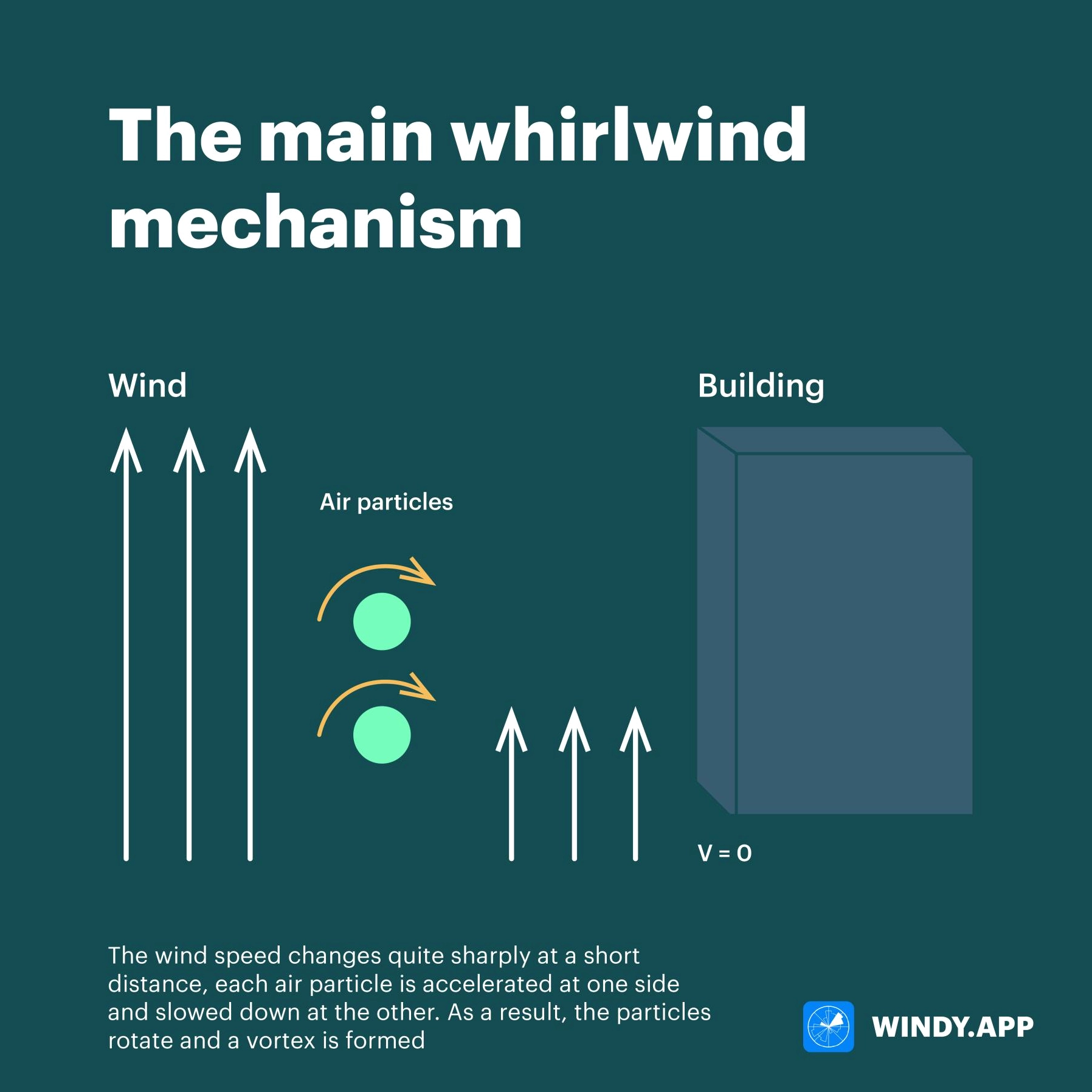
- Instability and Updrafts: This temperature difference creates an unstable atmospheric condition. A localized pocket of this superheated air begins to rise rapidly through the cooler air above it. This sudden uprush of hot air causes surrounding air to rush inward towards the base of the rising column.
- Rotation and Intensification: As the air converges and rises, it can begin to rotate. This rotation can intensify due to vertical stretching, similar to how an ice skater spins faster when they pull their arms in. The continuous inflow of warm air fuels the vortex, creating a self-sustaining circulation.
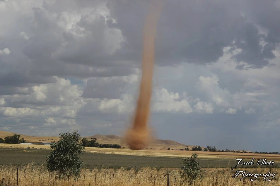
- Visibility and Dissipation: The rising air cools and eventually descends in the center of the vortex. The dust and debris picked up from the ground make the vortex visible, appearing as a towering, funnel-like column. A dust devil typically dissipates when the supply of warm, unstable air is cut off or the atmospheric balance is disrupted.
Dust Devil vs. Tornado: Key Distinctions
While both are rotating columns of air, understanding the differences between dust devils vs. tornadoes is crucial:
| Feature | Dust Devil | Tornado |
|---|---|---|
| Formation Mechanism | Surface heating, atmospheric instability | Tornadoes form from severe thunderstorms (supercells) |
| Parent Cloud | Typically form under clear skies or with scattered clouds | Always associated with cumulonimbus clouds (thunderstorms) |
| Wind Speeds | Can reach 60 mph or more in larger ones | Can exceed 300 mph in extreme cases |
| Size | Generally smaller (10-300 ft diameter) | Can be much larger (up to miles wide) |
| Duration | Typically minutes, sometimes up to an hour | Can last from minutes to over an hour |
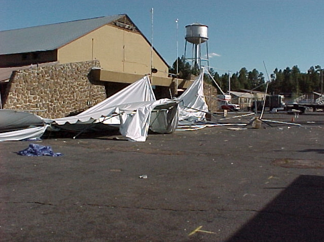
| Destructive Potential | Can damage small structures, lift debris | Extremely destructive, capable of leveling buildings |
Occurrence of Dust Devils
Dust devils occur in many parts of the world, particularly in hot, dry, and dusty environments. Areas with significant solar heating and loose surface materials are prime locations. They are common in deserts and open plains.
Dust Devils in Northern Arizona
Northern Arizona, with its combination of southern latitude, increased solar heating, dry sandy soils, and vast lightly vegetated terrain, is a region where dust devils frequently form. The necessity of warm, clear days and light winds means they are most common in May and June, but they can appear at any time of the year under suitable conditions. These desert-born phenomena in northern Arizona can sometimes reach impressive heights and persist for extended periods.
The Broader Context of Dust Devils
While not as powerful as tornadoes, dust devils can still pose a localized hazard by lifting dust, which can reduce visibility, and by damaging or destroying small structures if they are in the path of a strong vortex. Their formation serves as a visible demonstration of atmospheric instability driven by solar heating.
The concept of a dust devil is often encountered in various contexts, from meteorological discussions to popular culture references like 'dust devil meaning' in everyday language or even fictional portrayals in media such as 'dust devil movie' or game mechanics like 'dust devil 5e'. Regardless of the context, the core phenomenon remains a fascinating display of nature's power.
Conclusion: The Ever-Present Whirlwinds
Dust devils are a captivating aspect of weather, born from the simple yet powerful interaction of sunlight, the Earth's surface, and the atmosphere. Their formation process, distinct from that of tornadoes, highlights the dynamic nature of our weather systems. While generally less threatening, their presence serves as a reminder of the forces at play in the natural world. By understanding their characteristics and how they form, we gain a deeper appreciation for these dusty whirlwinds that grace our skies.
Comments (1)
Sarah Chen
14:14:27 21-07-2026Leave a Reply
Your email address will not be published. Required fields are marked *