Understanding Cirrocumulus Clouds: Features and Significance
The Intriguing World of Cirrocumulus Clouds
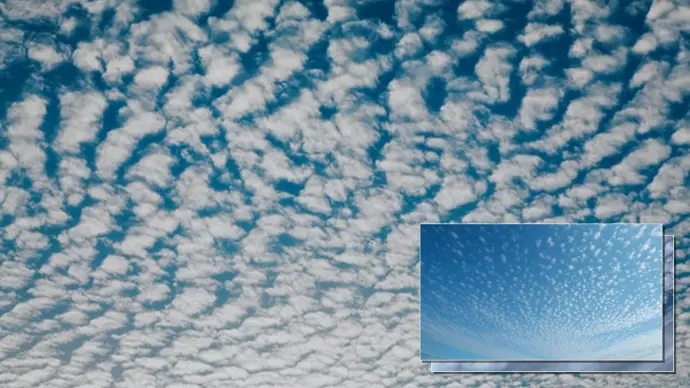
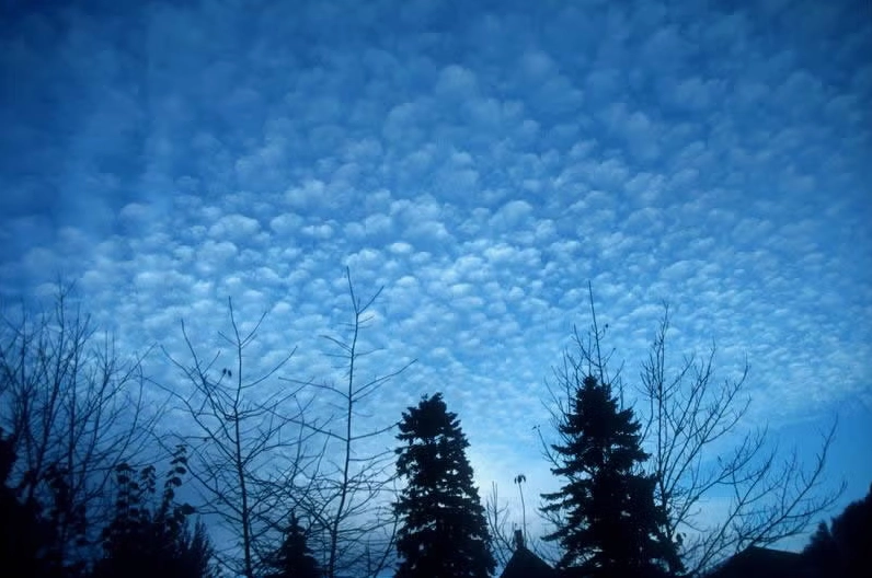
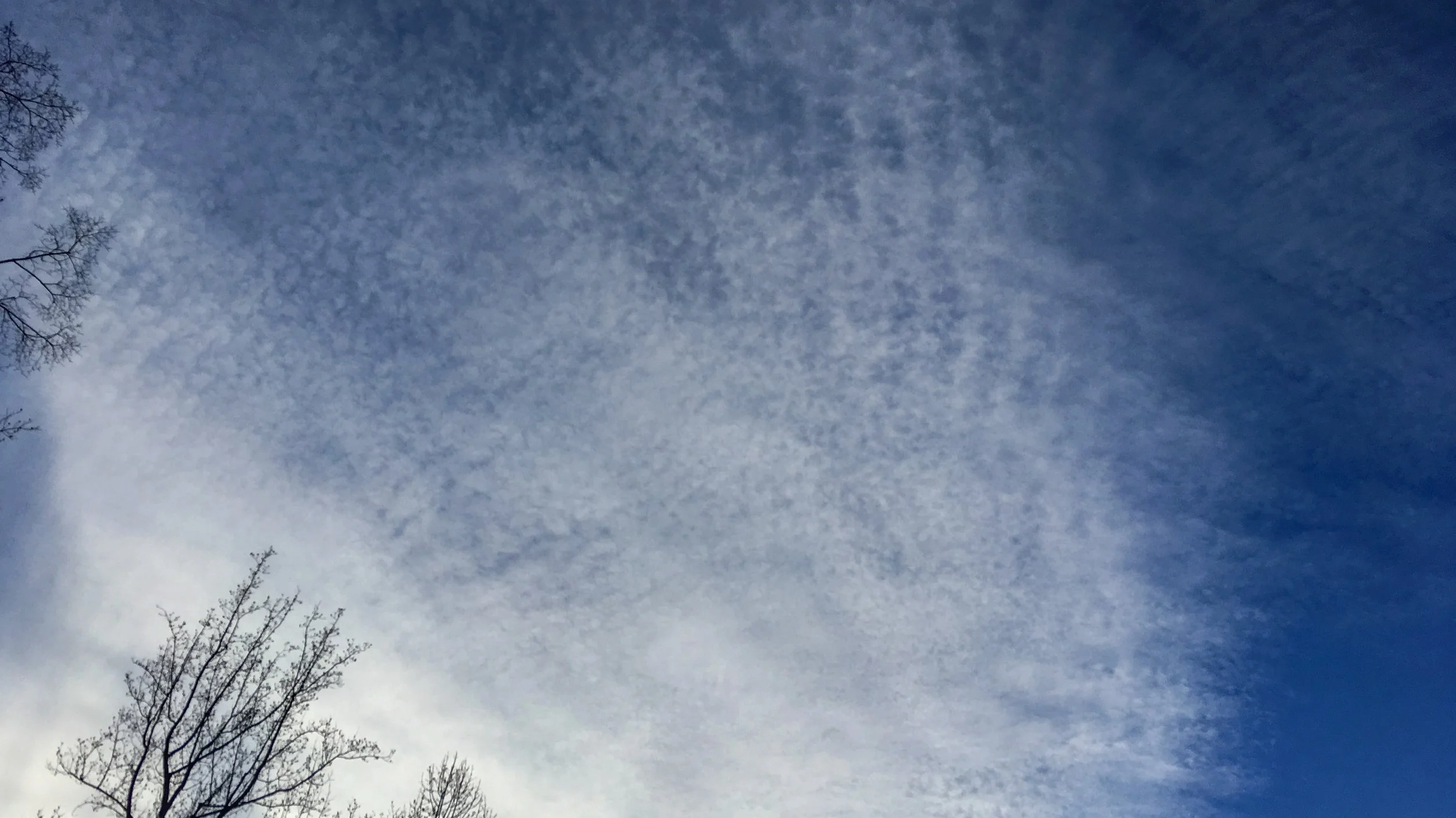
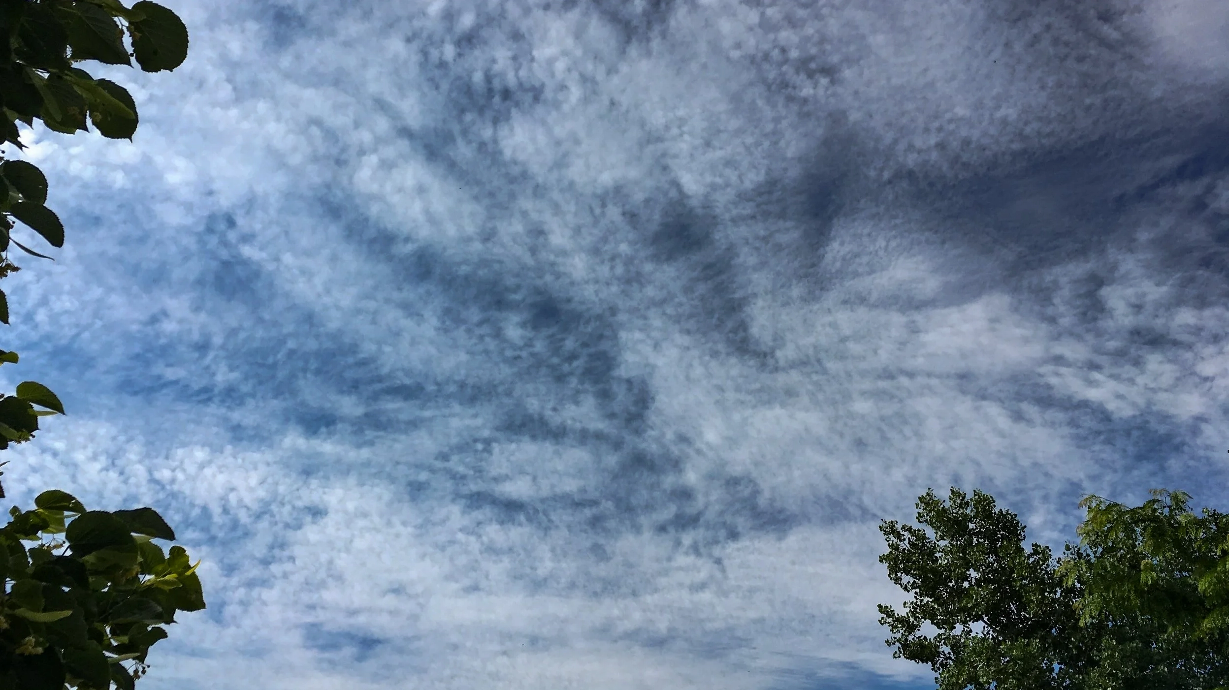
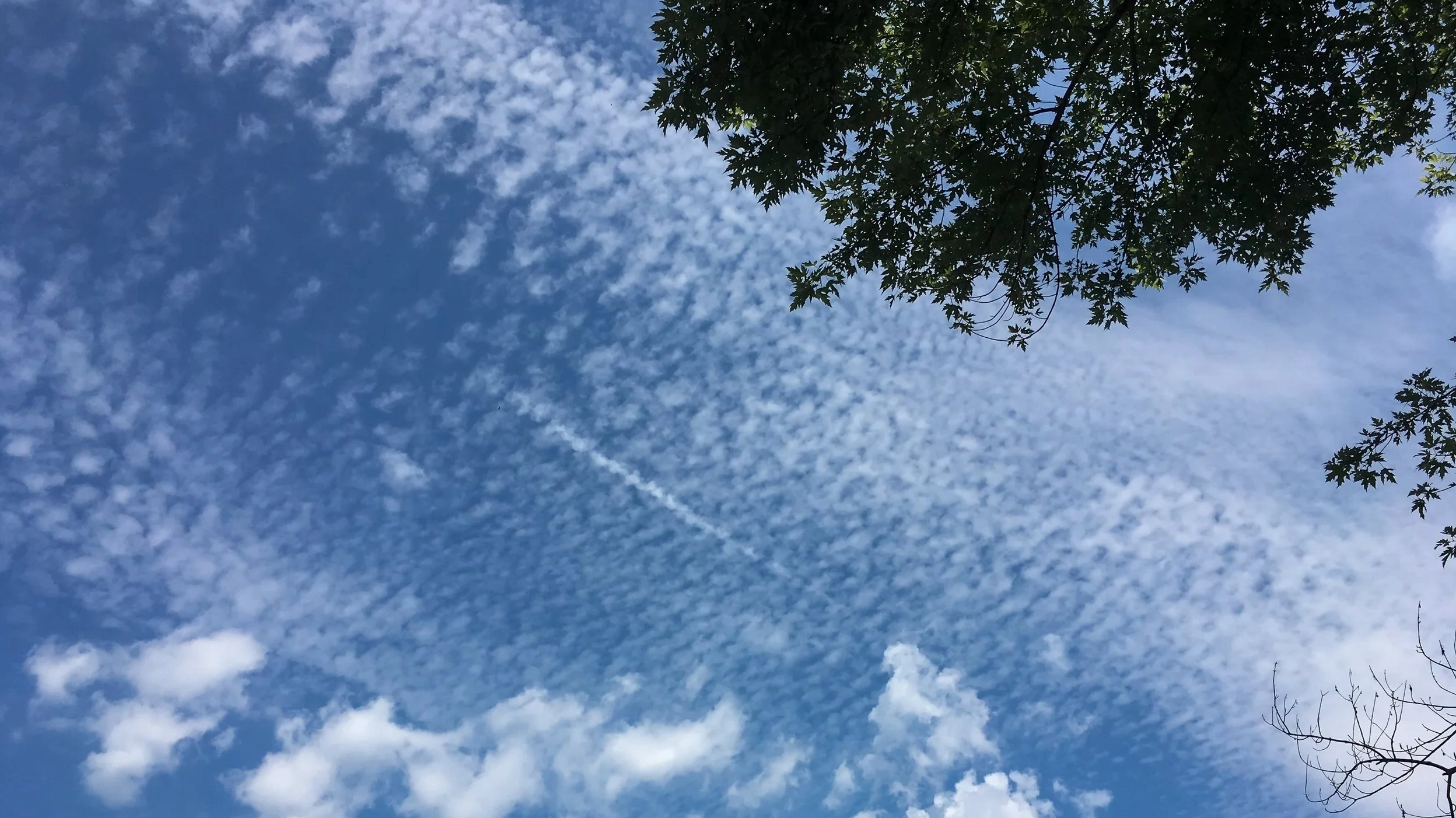
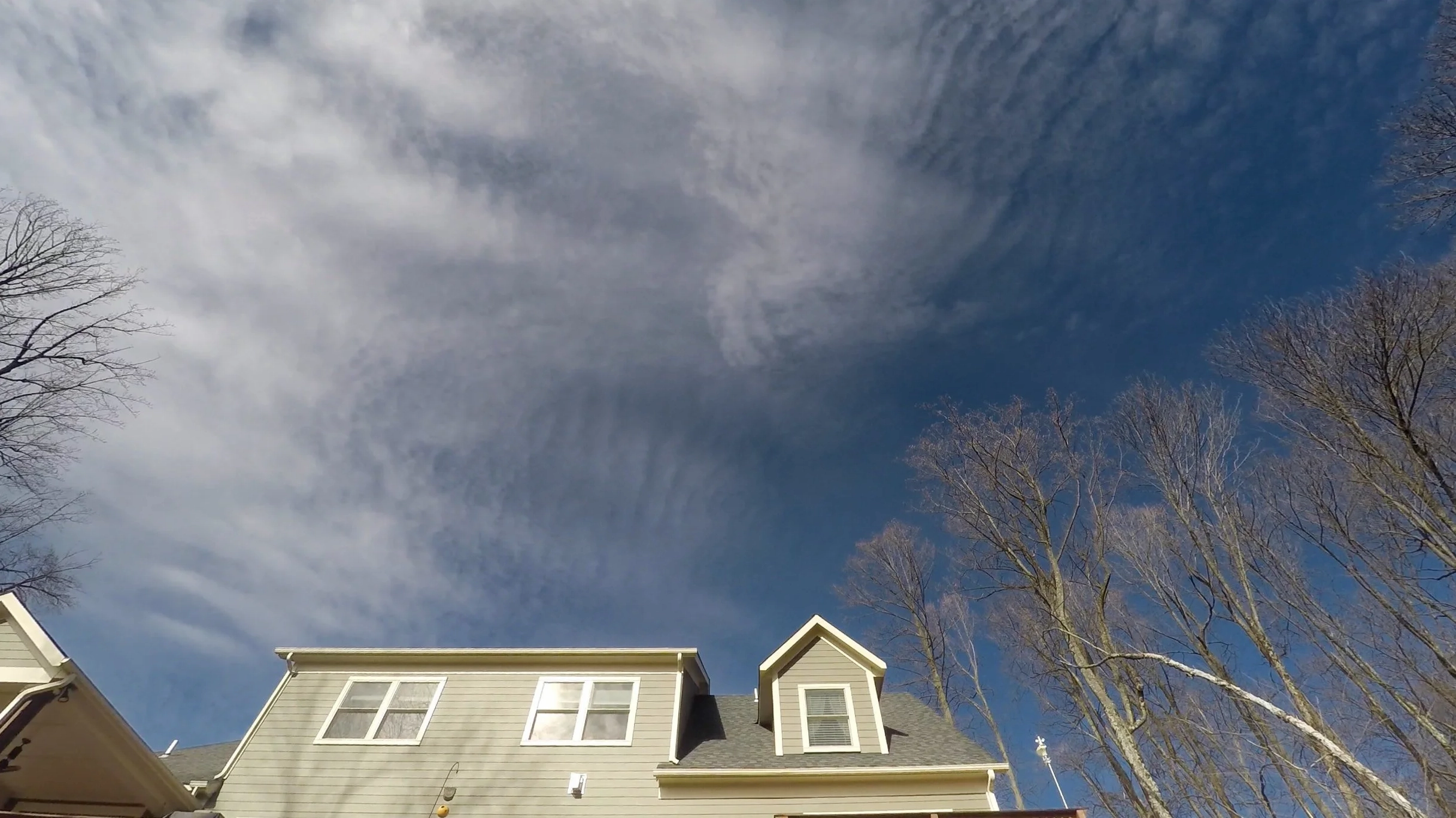
Cirrocumulus clouds, often recognized by their delicate, patchy appearance, represent a fascinating aspect of our atmosphere. These high-altitude clouds are characterized by small, rounded puffs arranged in long rows, creating a visual spectacle often described as a 'mackerel sky.' While they may seem ethereal, understanding their composition and behavior provides valuable insights into atmospheric conditions. This article delves into the essential cirrocumulus clouds information, offering a comprehensive description and exploring their significance.
Decoding the Cirrocumulus Clouds Meaning
The term 'cirrocumulus' itself offers clues to its nature. Derived from Latin, 'cirro-' signifies a curl or wisp, and 'cumulo-' refers to a heap or pile. This combination accurately describes their appearance: small, detached heaps of cloud that are wispy in formation due to their high altitude. Understanding the cirrocumulus meaning is the first step in appreciating their unique meteorological role.
Detailed Description of Cirrocumulus Clouds
Cirrocumulus clouds are found in the upper troposphere, typically at altitudes between 5 to 15 kilometers (16,000 to 49,000 feet). They are composed primarily of ice crystals due to the frigid temperatures at these heights. Their appearance is distinguished by:
- Size and Shape: Small, rounded masses, often described as looking like grains of rice or flakes. When viewed at arm's length, individual cloudlets are usually smaller than the width of one's little finger.
- Arrangement: Frequently observed in long, horizontal rows or undulating patterns, leading to the 'mackerel sky' effect. This specific pattern resembles fish scales.
- Color: Typically white, but can appear gray, especially when they cover a significant portion of the sky.
- Composition: Primarily ice crystals, though they can contain supercooled water droplets.
Unlike cirrus or cirrostratus clouds, cirrocumulus clouds do not typically produce sun halos. However, they are capable of exhibiting iridescence and coronas under specific lighting conditions, adding to their visual intrigue.
Cirrocumulus Clouds Weather Implications
The presence of cirrocumulus clouds often indicates fair but cold weather. They are particularly common in winter. While they do not produce significant precipitation, their formation can suggest a change in atmospheric stability. Meteorologists observe these clouds as indicators, but they are not primary drivers of weather events like rain or snow. The cirrocumulus clouds weather association is generally one of impending cold, stable conditions.
Varieties and Species of Cirrocumulus
Cirrocumulus clouds exhibit several species and varieties, each with unique characteristics:
- Species:
- Cirrocumulus castellanus: Characterized by small, turret-like vertical developments.
- Cirrocumulus floccus: Appears as small, ragged tufts.
- Cirrocumulus lenticularis: Lens-shaped clouds, often associated with mountainous regions.
- Cirrocumulus stratiformis: A horizontally layered form.
- Varieties:
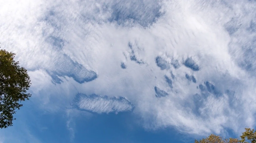
- Cirrocumulus lacunosus: Features a perforated or 'net-like' appearance with rounded holes.
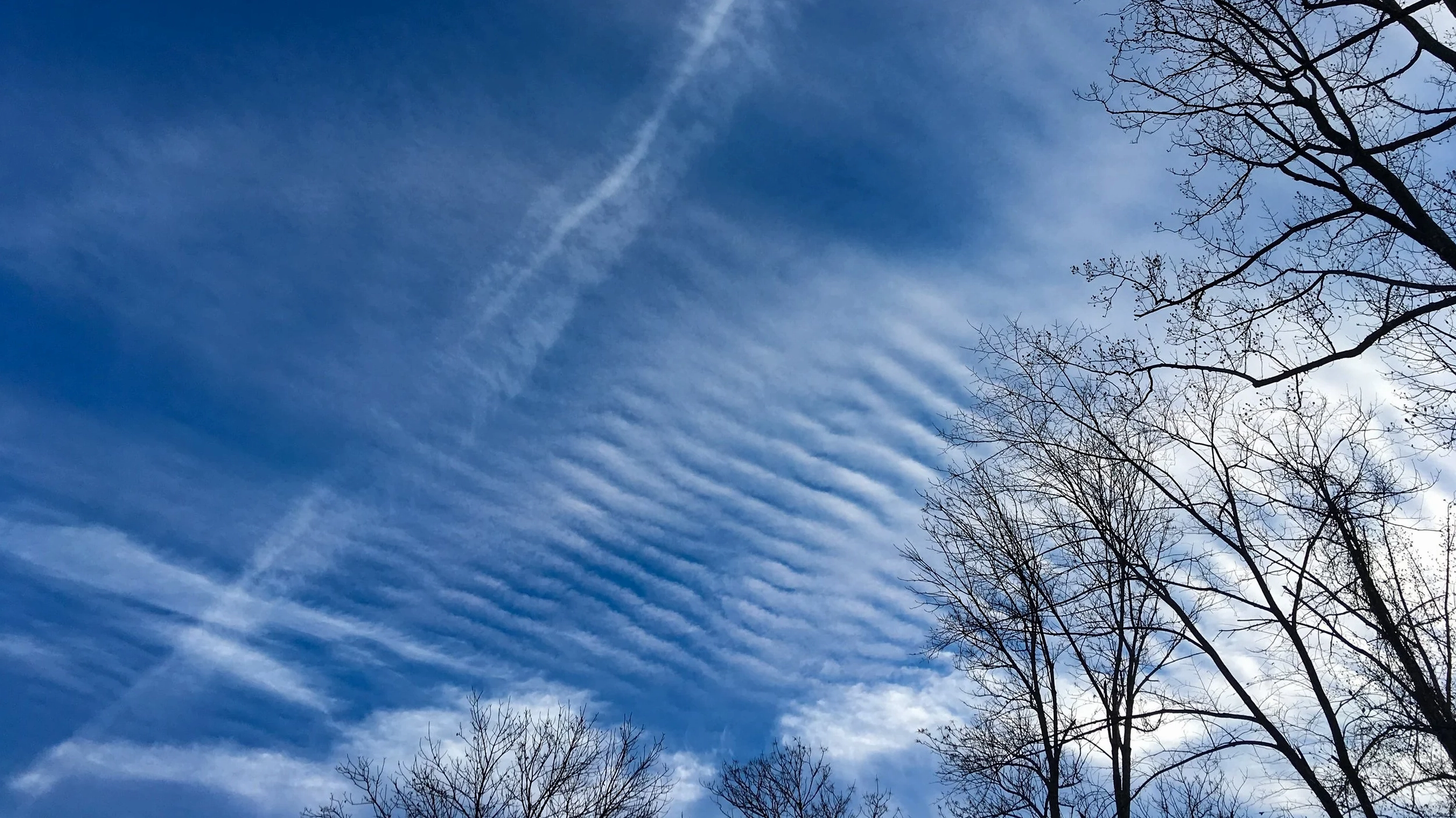
- Cirrocumulus undulatus: Exhibits wave-like patterns.
- Supplementary Features:
- Cirrocumulus cavum: Also known as a fallstreak hole, it's a large circular or elliptical gap in the cloud.
- Cirrocumulus mamma: Pouch-like protrusions hanging from the underside of the cloud.
- Cirrocumulus virga: Trails of precipitation that evaporate before reaching the ground.
Observing these specific types, such as Cirrocumulus stratiformis undulatus or Cirrocumulus floccus, can offer finer details about atmospheric dynamics.
Distinguishing Cirrocumulus from Similar Cloud Types
It is common to confuse cirrocumulus clouds with other high-altitude clouds like cirrus and cirrostratus, or even mid-level altocumulus. However, key differences exist:
- Cirrocumulus vs. Cirrus: Cirrus clouds are fibrous and wispy, composed solely of ice crystals and often appear as delicate streaks. Cirrocumulus clouds, in contrast, have a puffy, 'heap-like' structure, resembling grains of rice.
- Cirrocumulus vs. Cirrostratus: Cirrostratus clouds form a thin, sheet-like veil that can create a halo effect around the sun or moon. Cirrocumulus clouds are distinctly broken into individual cloudlets.
- Cirrocumulus vs. Altocumulus: Both can form a mackerel sky, but altocumulus clouds are found at lower altitudes and their cloudlets appear larger, roughly the size of your thumb held at arm's length. Cirrocumulus cloudlets are significantly smaller.
Accurate identification is crucial for understanding weather patterns and atmospheric phenomena.
The Role of Cirrocumulus in Meteorology
While cirrocumulus clouds themselves do not produce precipitation, their formation indicates specific atmospheric conditions. They form when moist air at high altitudes cools to its dew point and rises in convective currents, forming small ice crystals. The 'mackerel sky' often suggests that a change in weather may be on the way, typically moving from fair conditions towards potentially more unsettled weather, especially if a warm front is approaching.
Conclusion: Appreciating the Cirrocumulus Cloud
Cirrocumulus clouds, though uncommon, are a beautiful and informative part of our sky. Their unique appearance, from the 'mackerel sky' to distinct species like cirrocumulus castellanus, offers clues about atmospheric processes. By understanding their characteristics and distinguishing them from similar cloud types, we gain a deeper appreciation for the dynamic nature of our weather. Keep looking up; you might just spot these delicate ice crystal formations painting the sky.
Comments (0)
No comments yet. Be the first to share your thoughts!
Leave a Reply
Your email address will not be published. Required fields are marked *